The Travels of Tug 44 |
|
Erie Canal - Old Lock 41 Plantation Island, Herkimer |
| On April 22, 2007 (a day which will live in infamy), we made an Expedition to Plantation Island (also known as Lock 18 Island) near Herkimer on the Erie Canal. With me were Howard Ohlhous, a very knowledgeable canal buff, and Amy O'Shea, author of several books on the Old Erie Canal. One could not want a better crew than these two friends. The Island is criss-crossed with old canal beds, including the German Flats Canal of 1798, and the remains of old Lock 41 from the Enlarged Erie Canal. There is even a place with the cool name of Knock 'Em Stiff Rapids. It promised to be an exciting trip and the three of us were looking forward to it. I'd expected the 4 mile round-trip walk from Lock E-18 could be done in about 3 hours, but the towpath vanished after only a few hundred yards. We had to walk the rip-rap rocks on the canal bank, and then we pushed and shoved through the pricker bushes the rest of the way. The Island is completely overgrown with nearly no sign of human visits, just lots of deer sign everywhere. The 3 hour tour turned into 8 painful hours. It was unusually hot that day, and I ran out of water and started dehydrating. Amy had planned correctly, and she was the only one in reasonable shape by the end of the day. Me? I was a total wreck ...
Still, it was a memorable day with excellent friends! Here are some of my pictures from that day: |
 |
|
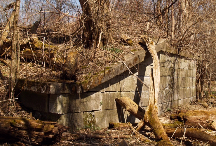
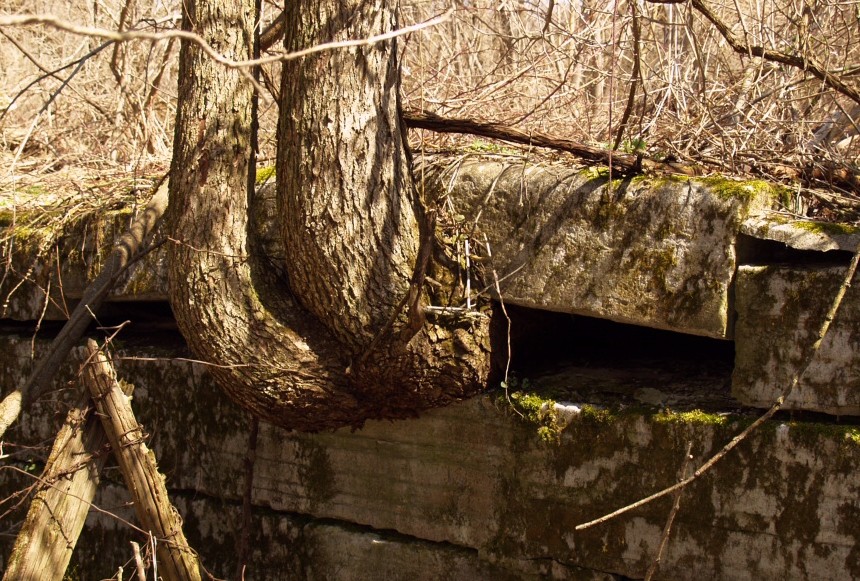
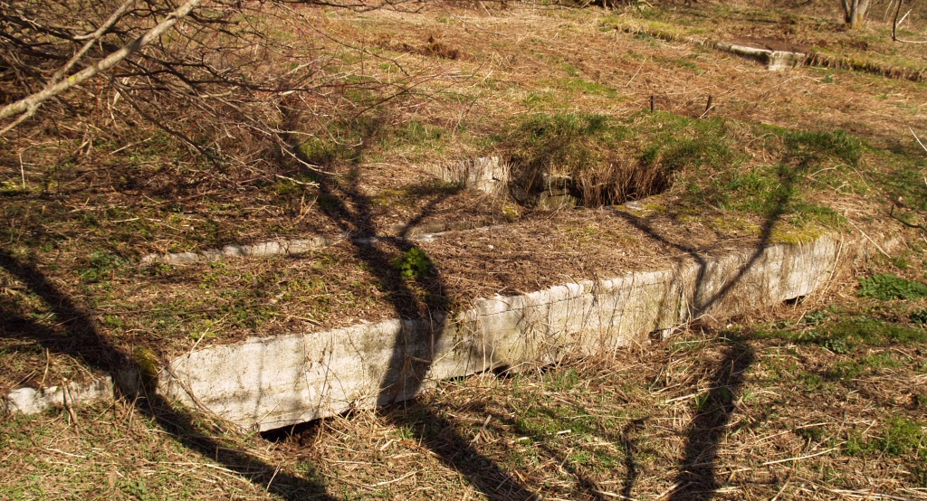
This is the first construction we came upon, the remains of a bridge over the old Erie, dating back to Civil War times. The bridge itself is long gone, but the old hand-cut stone of the abutments is still in reasonable condition after 150 years, in spite of the huge trees growing on top. Eventually the tree roots will destroy the site, but for now it's ok.
|
 |
|
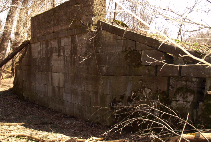
The other bridge abutment is basically identical, except for a section of poured concrete on top, which raised the bridge on one end. It was judged cheaper to simply jack up the bridge on one end, than to do it on both ends. Note the heavy growth of moss on this north-facing stonework, which is shaded and therefore wetter than the other one.
|
 |
|
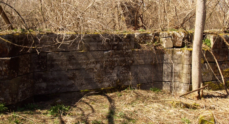
Here is our first look at old Lock 41. This is outside of the western wall, and we see the original oak "snubbing posts" still existing. Canal boats tied up to these posts while in the lock. It's rather impressive to see 100 year old oak posts survive about 100 years out in the elements. Notice the very heavy growth of moss on all the stonework. This lock was built about 1850, enlarged in 1891, and abandoned around 1918 when the modern Canal was completed. It provided an 8 foot lift.
|
 |
|
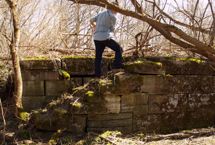
That's Howard going up the original stairway at the lower end of the west lock chamber. The steps are in good shape, but completely covered in plant debris.
|
 |
|
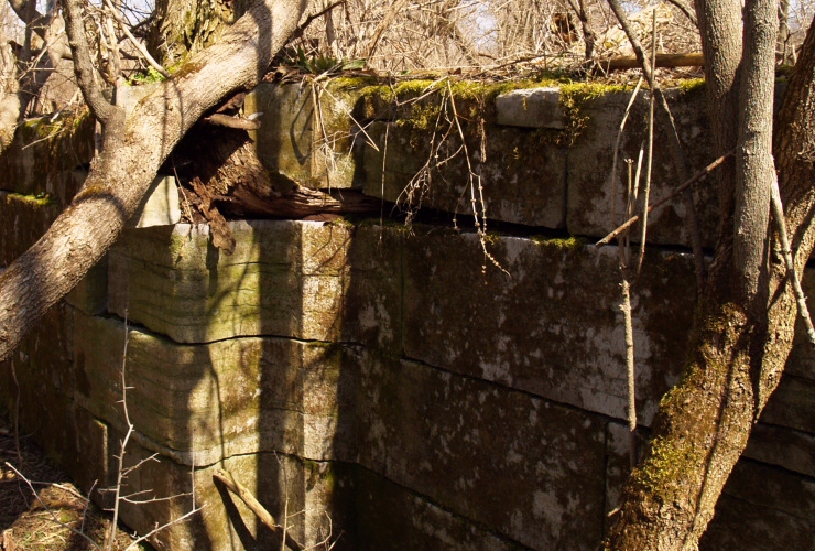
Nature has done some major damage to this old lock. Here the trees are growing between the stones and forcing them apart. Somebody needs to get a chainsaw, and soon!
|
 |
|
This recessed area in the lock wall was where the doors folded into the wall. The beautifully rounded groove was where the door's hinge pin and seal was located.
|
 |
|
A view of the door groove on the westernmost wall.
|
 |
|
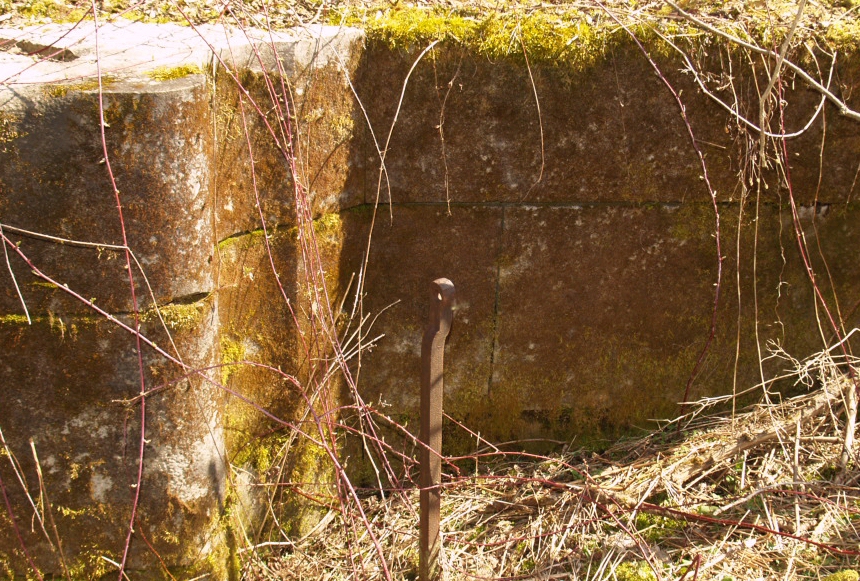
Here's an interesting wrought-iron post with a ring in the top. There are a number of these at the site,each located near where a door once was. At first I didn't know what they were, until it was pointed out to me (thanks, Chris!), that they were control rods located on the old doors and were used to open flaps to let water through ports in the actual doors. Until then I had thought the valves were attached to tunnels underground as in modern gates, but nope, in this era they were right on the doors. This means that likely there are the bottoms of the original doors still on the site, buried under dredgings from the construction of the modern canal. Somebody, hand me my shovel!
|
 |
|
This is the face of the wall between the chambers, and barely visible are long slots which provided a spillway leading to underground tunnels, and out to the lower end of the lock. In the upper right is seen the nearly buried wall of the eastern lock chamber.
|
 |
|
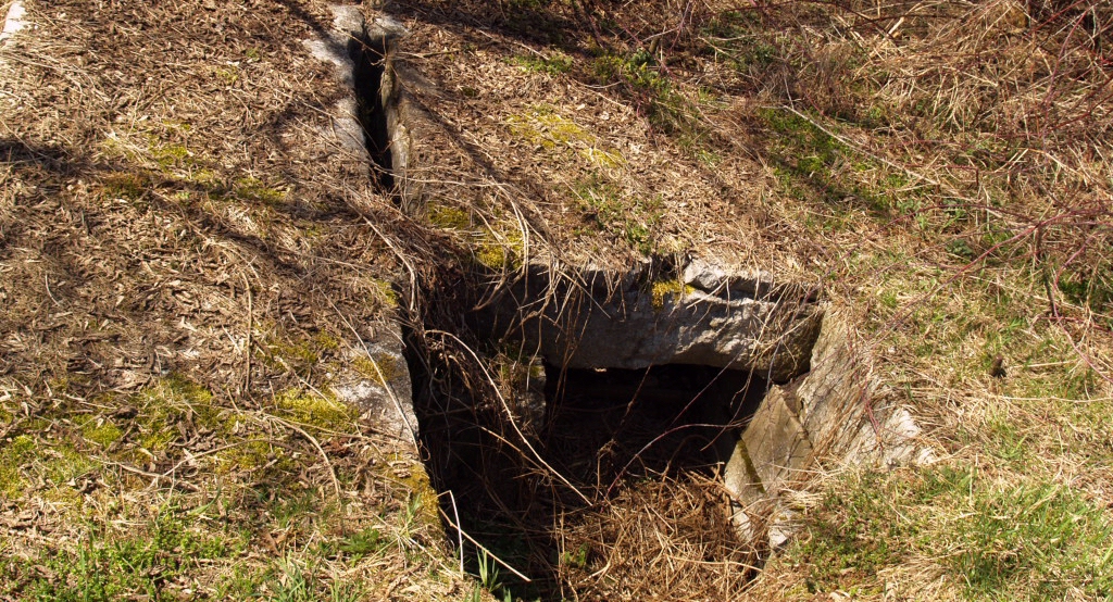
Nature has done her work on the tunnels too, here the stone covering the tunnel has collapsed, exposing the tunnel underneath. Caution!
|
 |
|
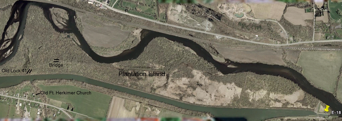
The satellite view shows the location of Old Lock 41, directly across the canal from the Old Fort Herkimer Church and the mouth of Spoon Creek. The white areas of the island are impenetrable swamps with standing water, and the gray-green areas are impenetrable brush with mud. Too small to appear on the satellite view are rather pretty deer meadows scattered here and there.
See full-sized photo.
|
May 2011: |
 |
|
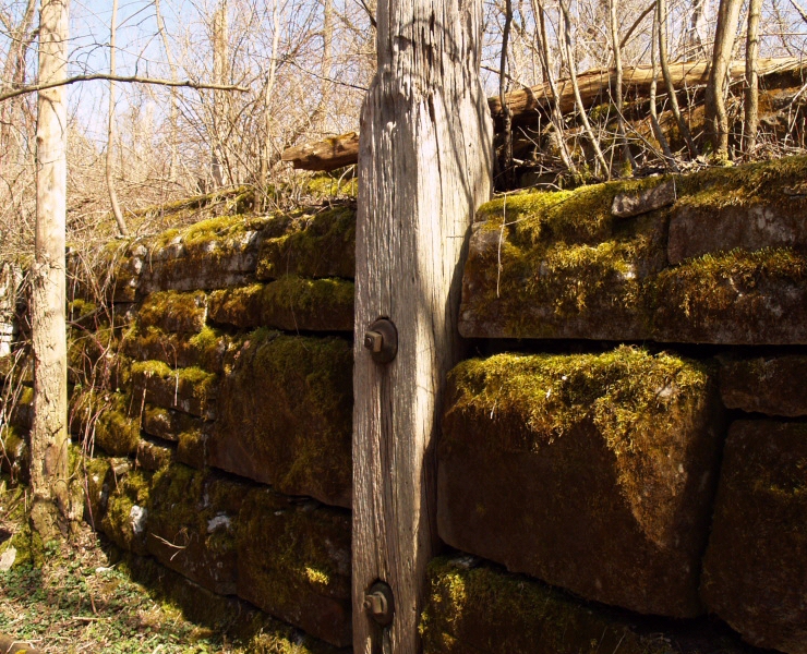
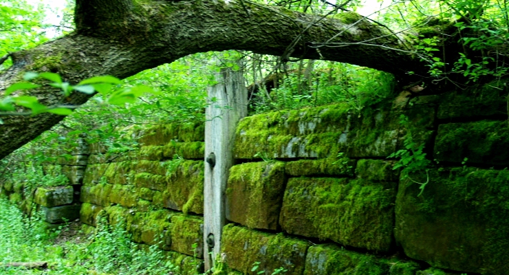
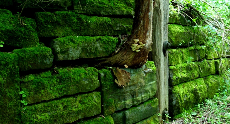
In May 2011, we returned, this time a bit later in the season after everything had greened up. The stones bear a tremendous growth of moss, encouraged by the perpetual shade from the trees that have completely overgrown the area.
|
 |
|
Another old original beam from when the lock was still working, and a tree trunk growing out of the stones. Damage from tree roots is one of the major causes of destruction of the old lock walls.
|
Lighthouses - Canal Corp Boats - Tugboats & Trawlers