The Travels of Tug 44 |
|
Fort Edward Flood 2011 |
 |
|
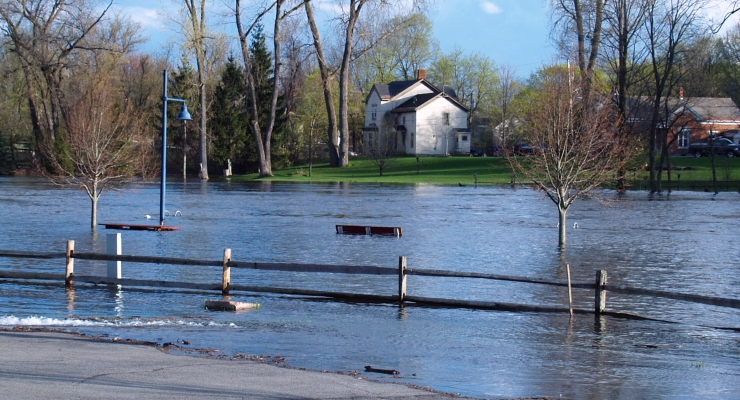
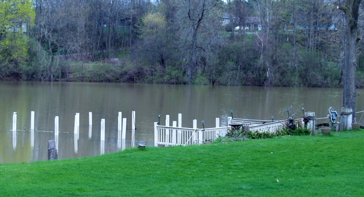
April 28, 2011 - A combination of snow melt and torrential rains caused high water levels and unexpected flooding on the New York Canal System, including at my hometown Fort Edward. This view shows the Fort Edward Yacht Basin, now completely submerged with about 10 feet of extra water. The things in the water are park benches on the shore. The power posts are completely submerged. The water is starting to fill in the parking lot of the Bank. The next day the water came over the fence.
|
 |
|
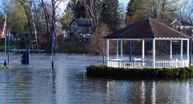
The gazebo near the pier is now an island, about 50 yards offshore. Rogers Island in the background. The water later rose to cover the hedges.
|
 |
|
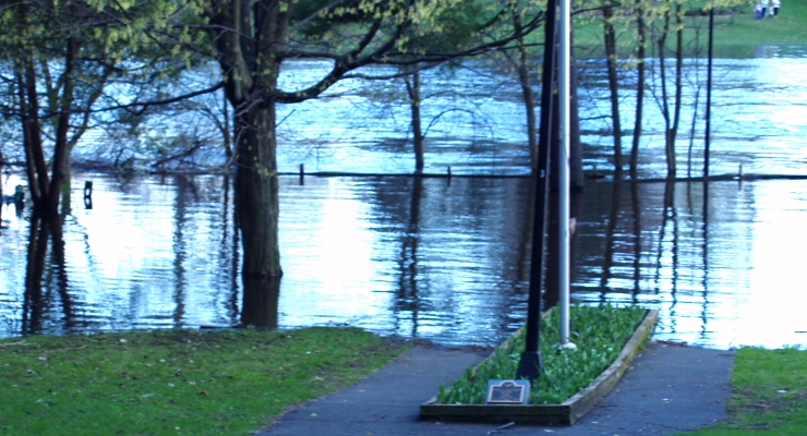
Fort Edward's Underwood Park could now be called Underwater Park. The next day, the water completely covered the flower bed and only the little plaque was visible.
|
 |
|
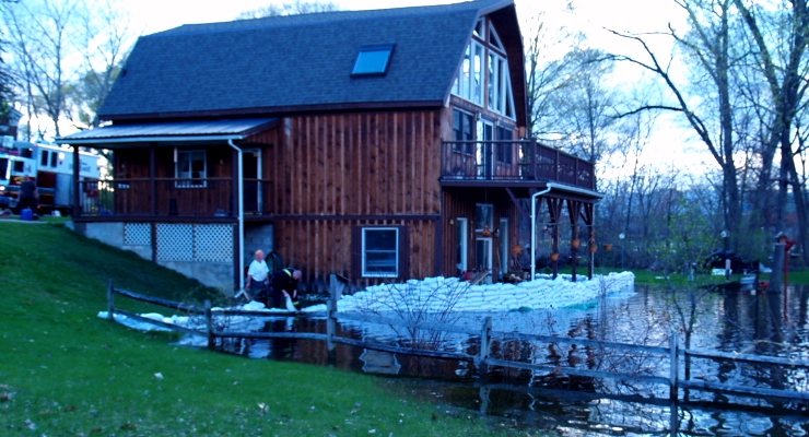
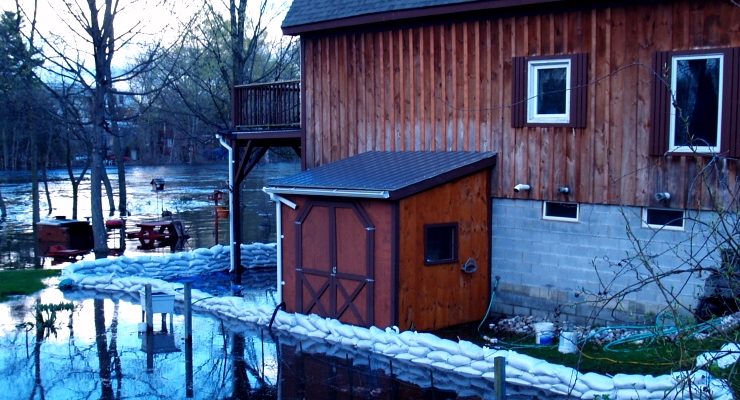
Things were particularly bad on Rogers Island across from the Yacht Basin. Here the Fire Department and many volunteers are busily making sandbags to protect a waterfront house.
|
 |
|
The water level inside the sandbagged area is starting to drop as the Fire Department gets their pumps going. It was all futile as the river rose above the sandbag wall and flooded the house up to the windows.
|
 |
|
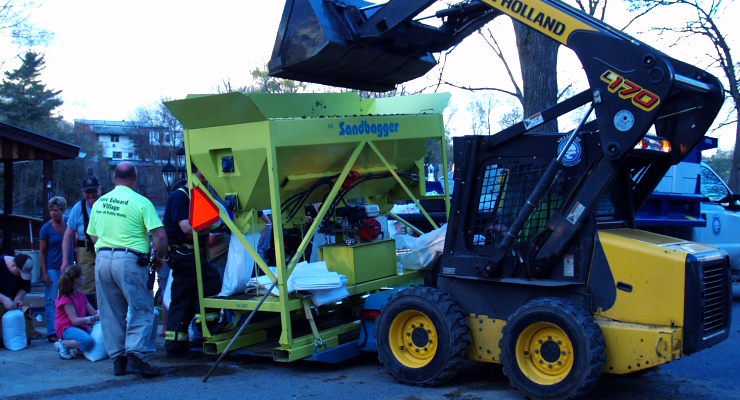
Amazing what can be accomplished quickly with this sandbagger machine and 50+ volunteers. The machine dispenses sand thru a tube into bags then carried away by waiting volunteers. The machine fills 4 bags at a time.
|
 |
|
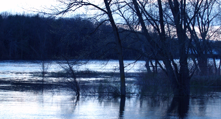
Parts of Rogers Island are completely submerged.
|
 |
|
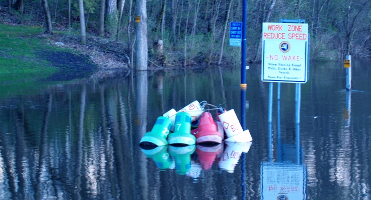
Because of high water levels and strong currents, Canal Corp had delayed putting the navigation buoys in. Here in the yard at Champlain Canal Lock C-7, a pile of buoys was awaiting deployment when floodwaters arrived. Luckily they are chained down to some concrete blocks else they'd be headed downstream. The lock is a few hundred yards from my house.
|
 |
|
My home, located in the man-made section of canal above Lock C-7, is normally safe from the river, but in this case the water back-flushed thru the lock and started rising. Here, my docks are submerged, though undamaged. My house stayed dry with about 4-5 feet to spare. Whew!
|
 |
|
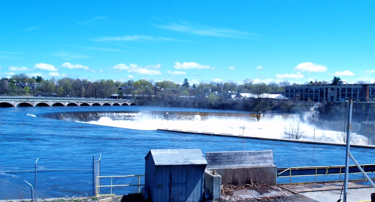
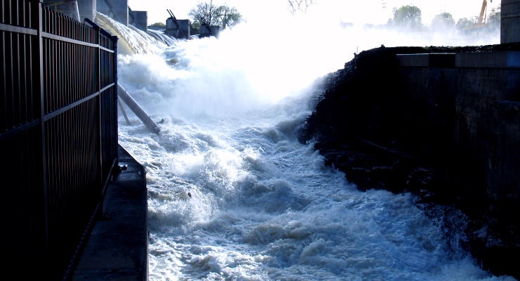
This dam in Hudson Falls, upstream from Fort Edward, continues to flow water in stunning amounts. The adjacent hydro-electric project operated by Boralex is not affected. That nice looking stone bridge in the upper left was condemned as unsafe some 30 years ago and replaced by a new bridge hidden behind it, yet the old bridge survived this torrent too.
|
 |
|
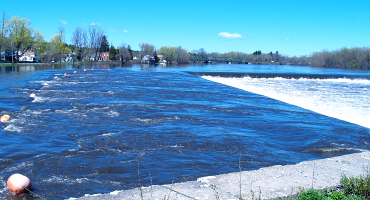
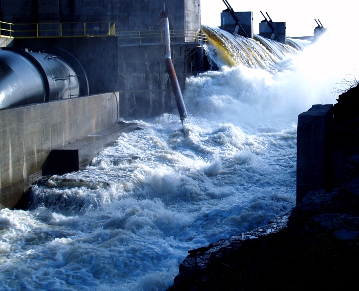
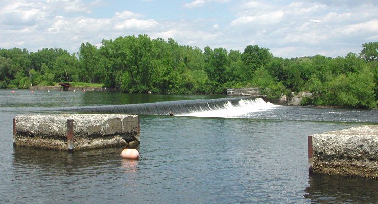
This is the Hudson River / Champlain Canal above Lock C-5 in Schuylerville. The canal runs off to the left as it enters the channel to the lock. The string of buoys is attached to a row of giant concrete blocks, normally rising 6 feet above the water, but now submerged. Normally it looks like this click. Notice there is not much of a drop below the dam, the water down there is really deep now too.
|
 |
|
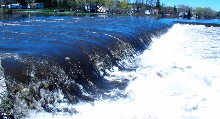
Another look at the water flowing over the Schuylerville Dam. That water is about 10 feet deep as it goes over.
|
 |
|
Dionondahowa Falls is a very high natural waterfall with a small hydroelectric plant on top, nicely concealed in the woods nearby. The incredible torrent is the Battenkill river, which feeds into the Hudson River just below Lock C-5, adding to the misery of folks downstream.
|
 |
|
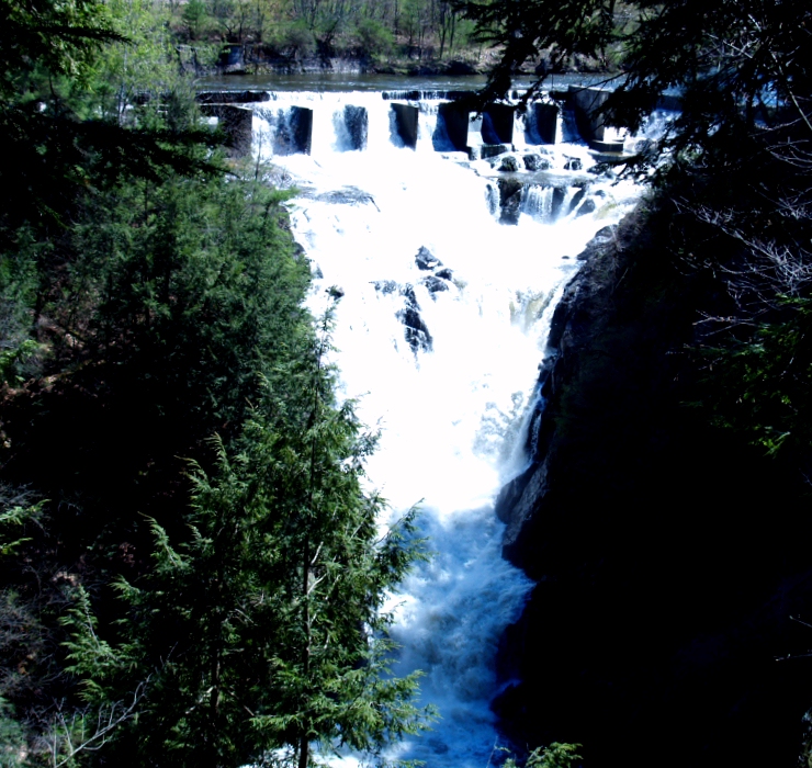
Glens Falls is churning like the inside of a blender as the raging torrent pours through a narrow gorge. This spot was made famous by James Fenimore Cooper in his book Last Of The Mohicans, as the location of a cave behind the waterfall. There are three small caves down by the normal water level but they are under 20 feet of water. The actual location of the incident the book was based on, the murder of Jane McCrae by Indians, took place in Fort Edward, two blocks from my home.
|
 |
|
Another look at Glens Falls.
|
Lighthouses - Canal Corp Boats - Tugboats & Trawlers